
Geology
Group Leader: Michael Regan
Tel: 01565 651406
Email: info@knutsfordu3a.co.uk
The Geology group meets on the second and fourth Tuesdays of each month, at 7:45pm. The meetings are a mix of some online (using Zoom) and some in-person at a member’s house. They usually feature a talk, supported by slides or geological specimens, by a member of the group. There are also several field trips each year.
The aim is to cover areas of both local and general geological interest. Recent meetings have featured talks on a range of geology-related subjects, including The Geology Of Cheshire, The Isle Of Arran, Mineral Resources For The Electric Future, Iceland, Cornwall, The Knutsford Borehole, the Formation and Structure of the Earth and Geological Time. There are also periodic round-ups of geology news.
Our field trips in recent years have included locations in Derbyshire, Alderley Edge, Staffordshire, Dudley, Anglesey, Heysham, Crummackdale, Lyme Park and the Knutsford Geology Trail. Some are described below.
Please contact Mike Regan if you are interested in joining the group.
Please click on the photos in the articles below to enlarge.
u3a Geology Field Trip To Anglesey, May 2025
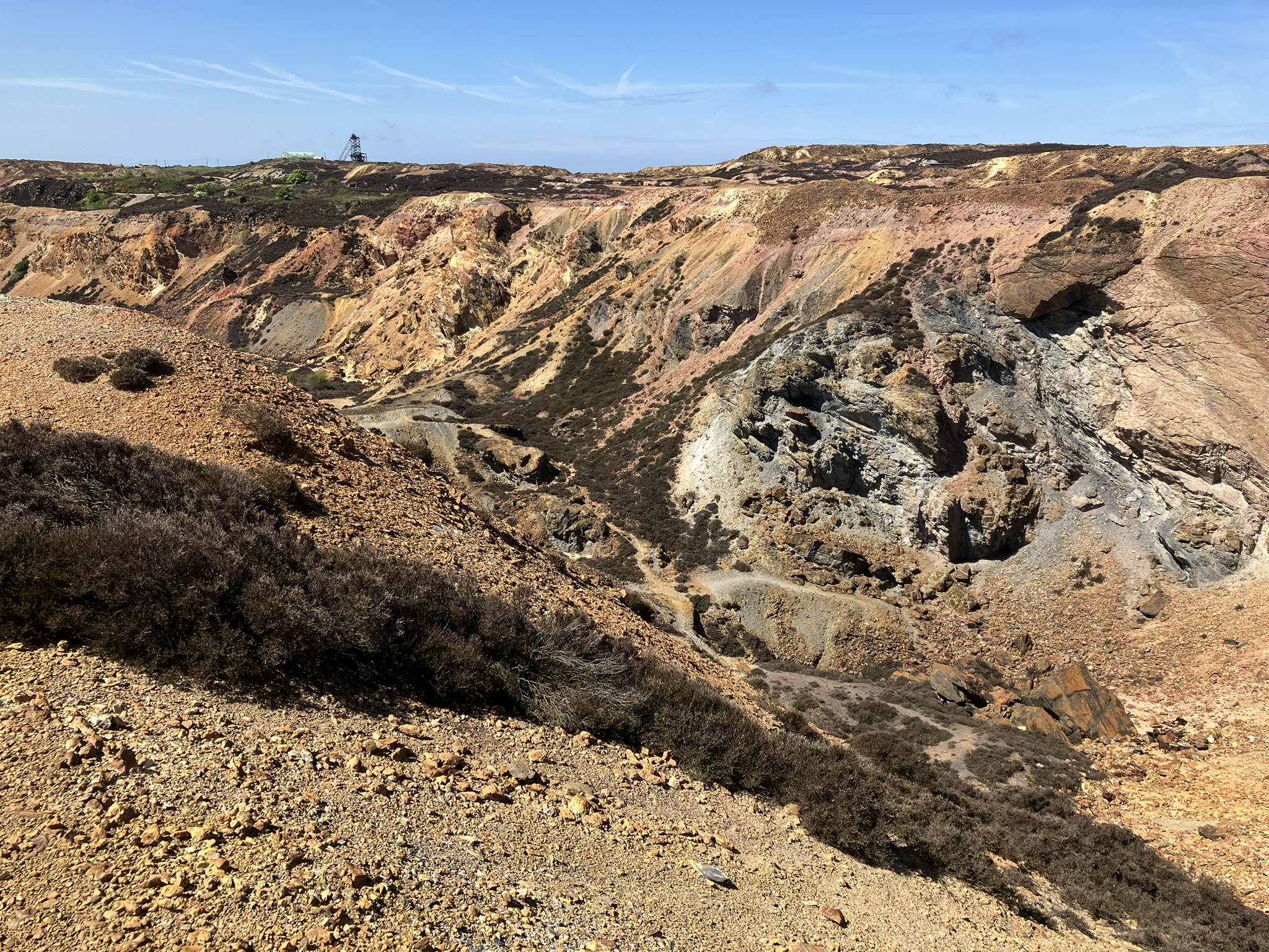
Anglesey is packed with geological highlights, some of them unique within the UK, and the geology group took a trip to see as many of them as we could pack into 2 days. We began at Parys Mountain, an opencast copper mine since the Bronze Age. 400 million years ago, this was at the bottom of an ocean where undersea volcanoes erupted. Along with the lava these brought metal-rich fluids which precipitated minerals on the seabed, and these formed the ores that the miners sought. Today the orange, red and pink mine-spoil makes it a dramatic landscape (photograph 1).
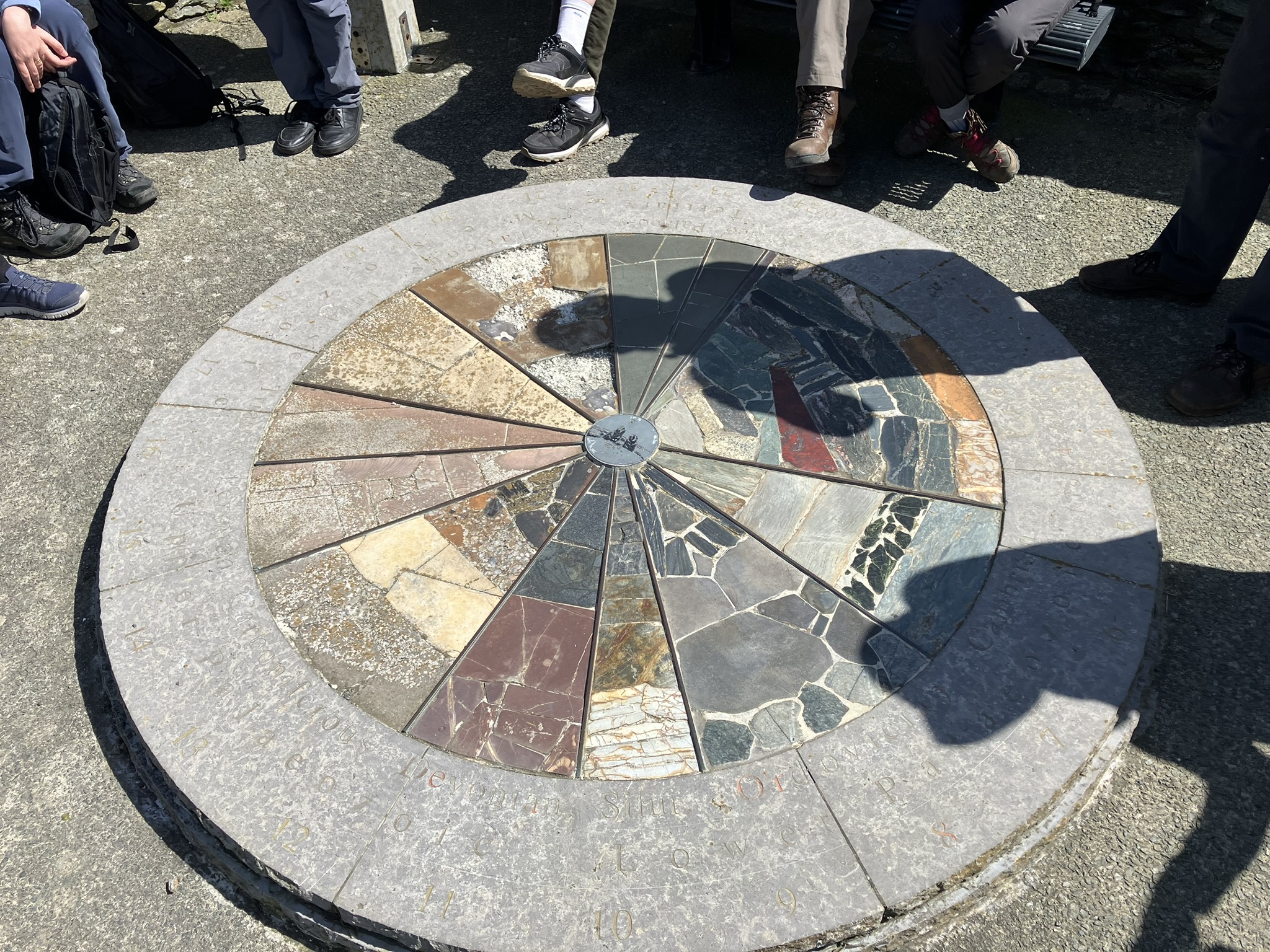
Anglesey is a UNESCO Global Geopark, GeoMon, with a visitor centre at Port Amlwch which is where we headed next. The GeoMon people kindly provided us with a lot of information about the fascinating geology of the island, and showed us their ‘Geological Clock’, made up of different local rock-types (photograph 2).
Last stop on Day 1 was Llanbadrig. Along the coast here is a complex jumble of apparently unrelated rock-types. It is called a “melange” and is believed to have formed at the base of an ocean trench, as pieces of rock from above were broken off by earthquakes and tumbled to the bottom. We puzzled over it for an hour before heading for a welcome dinner at the Valley Hotel. Day 2 started at Holyhead Country Park, where we looked at a hard, pure-silica rock called quartzite (photograph 3). It was quarried from Holyhead Mountain for use at a now-ruined brickworks, now an interesting visitor centre (photograph 4).
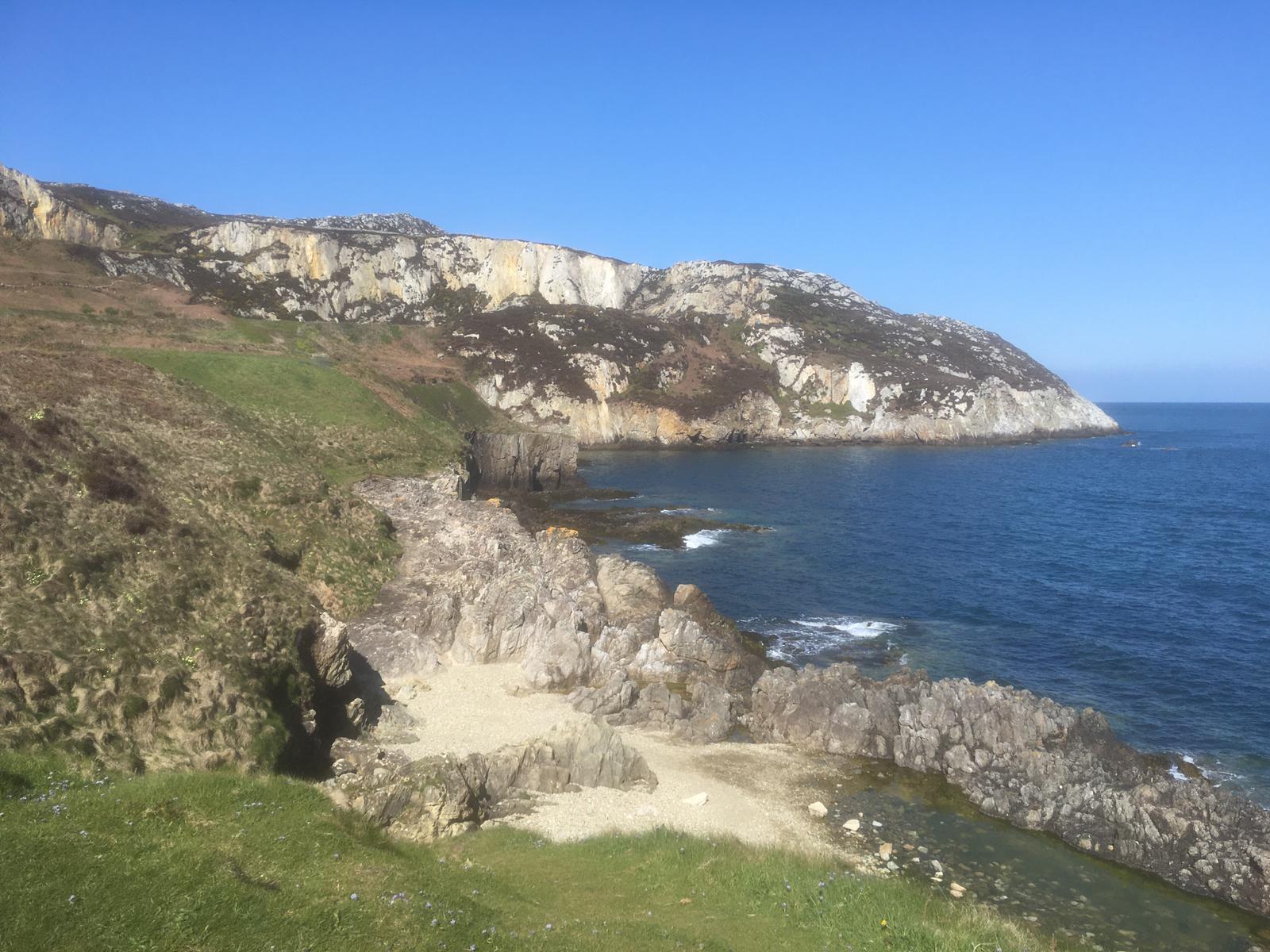
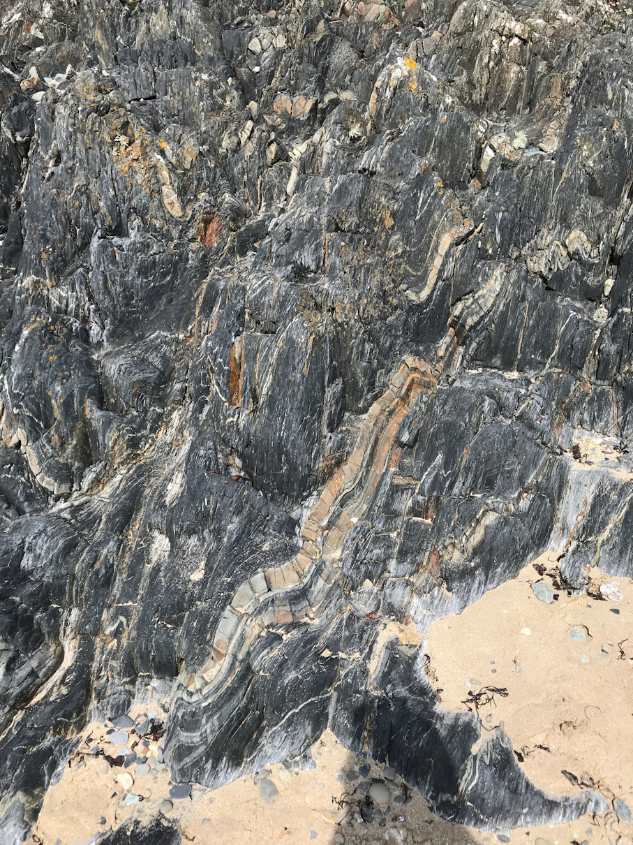
We lunched at Rhosneigr before exploring the beach, where black shales have been contorted and folded (photograph 5). Alongside them are older conglomerates, representing a period when this area was uplifted above sea level.
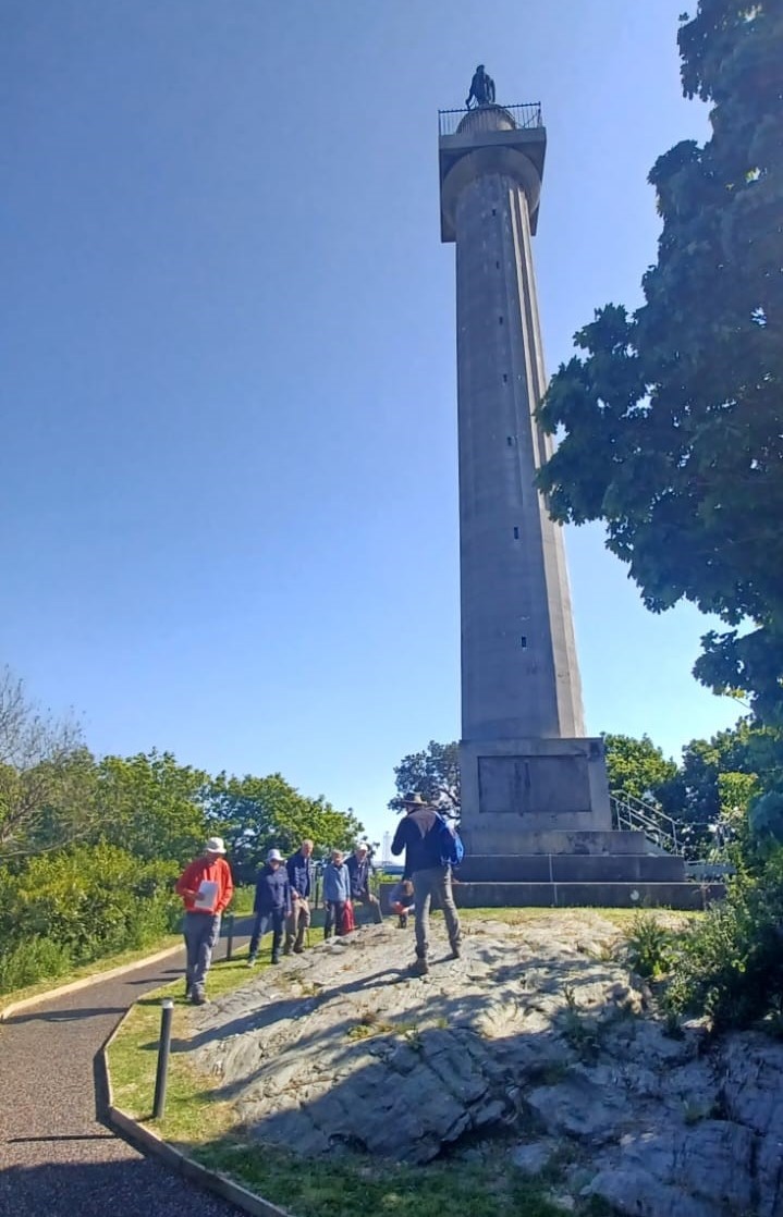
We finished at Llanfair PG – specifically the Marquess Of Anglesey column. It is built on an outcrop of blueschist, the only place in the UK where this type of rock is found. It has an unprepossessing appearance (photograph 6) but a fascinating history, beginning as volcanic lava on an ocean floor half a billion years ago. Subsequently it was buried to 40 kilometres depth, then uplifted by a mountain-building episode back to the surface.
u3a Geology Field Trip To Heysham, October 2024
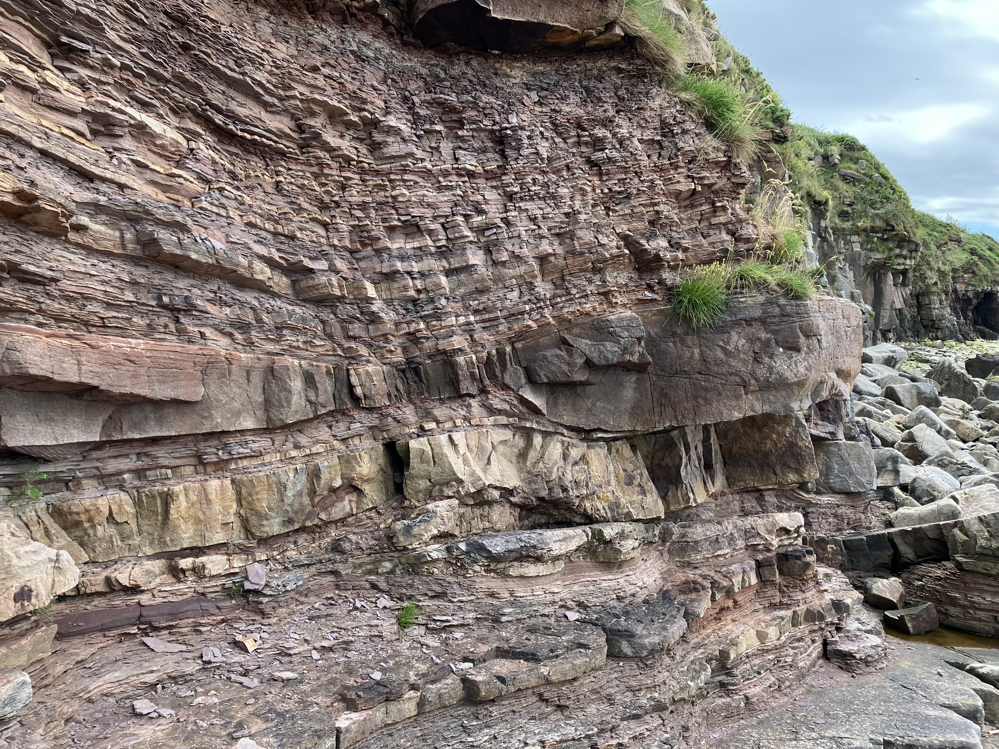
We visited Heysham Village on the Lancashire coast, overlooking Morecambe Bay. It is home to a ferry port, a nuclear power station and the ruins of an 11th century chapel with unusual stone graves and Viking remains, all of which we saw, but our focus was the Carboniferous and Triassic geology on the foreshore. 325 million years ago, the area was an equatorial delta formed by a large river system and the rocks we saw show the evidence of this. Thin beds of pink and orange sandstone were formed by the sediments swept here by the river channels in flood. The sandstones alternate with layers of dark shale, which was originally mud deposited in quiet areas of the delta – lakes, lagoons and blocked channels. The layers piled up one on top of another to eventually form the cliffs that we see today (photograph 1).
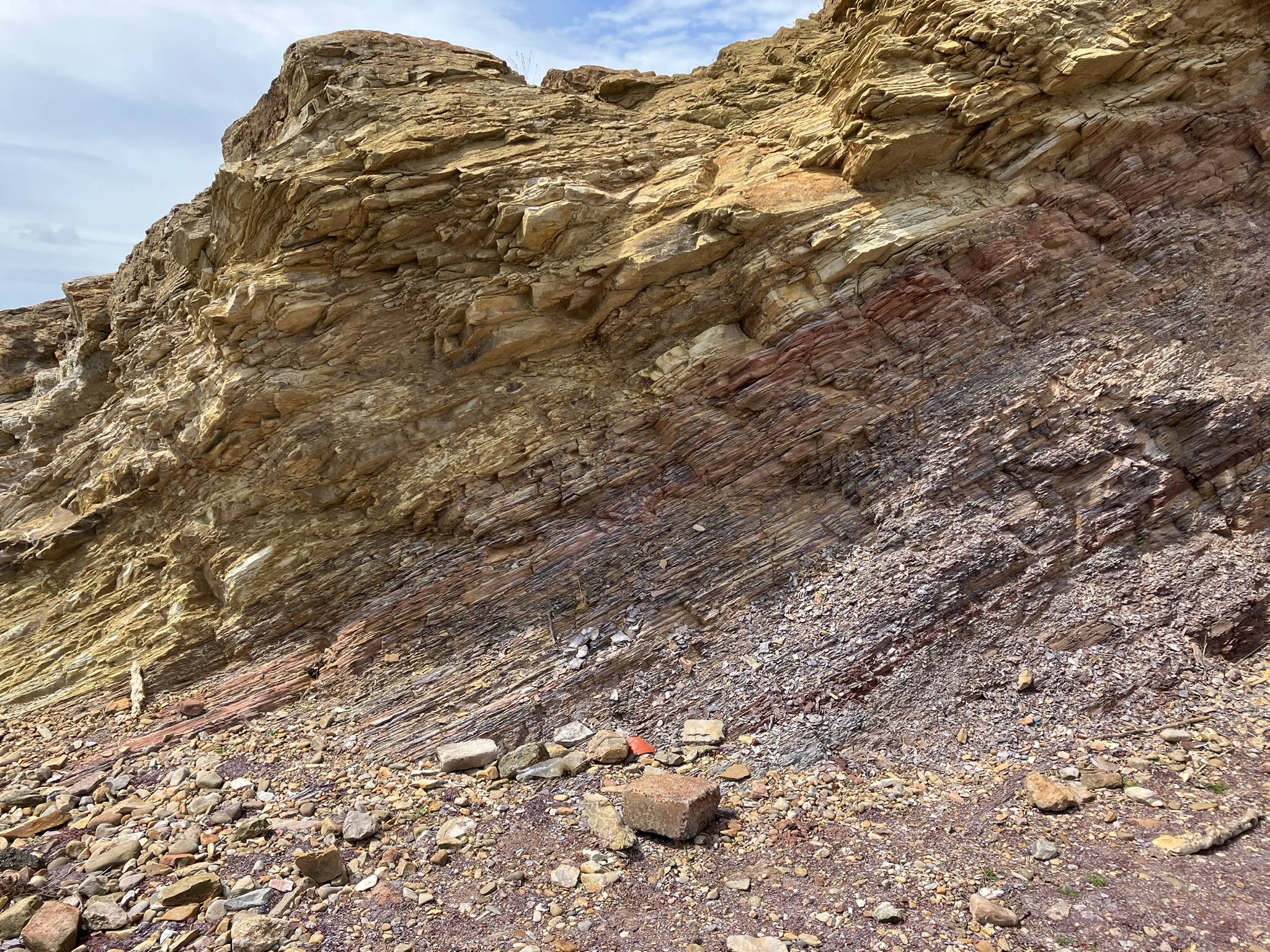
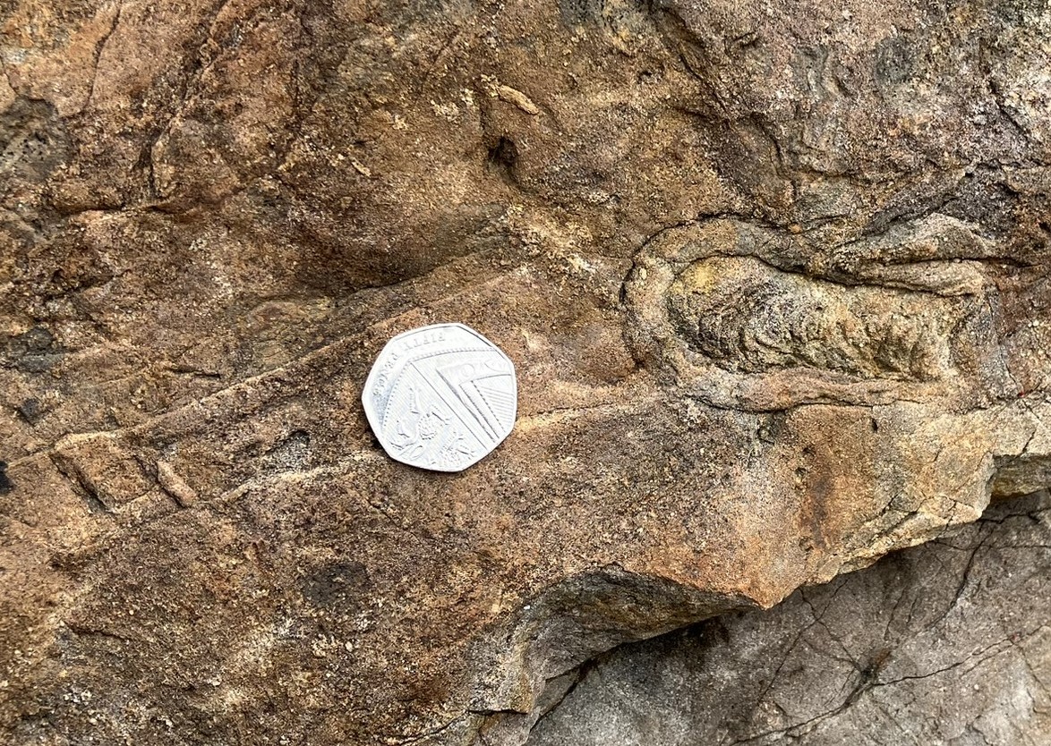
Further along the beach we came to a small but spectacularly-coloured cliff of shale rock, where bands of purple, red, orange and beige sit on top of each other (photograph 2). This reflected the changing chemistry of the original sediments as the delta developed. Nearby we found a plant fossil, probably an imprint of bark from the Carboniferous ‘tree’ Lepidodendron (photograph 3).
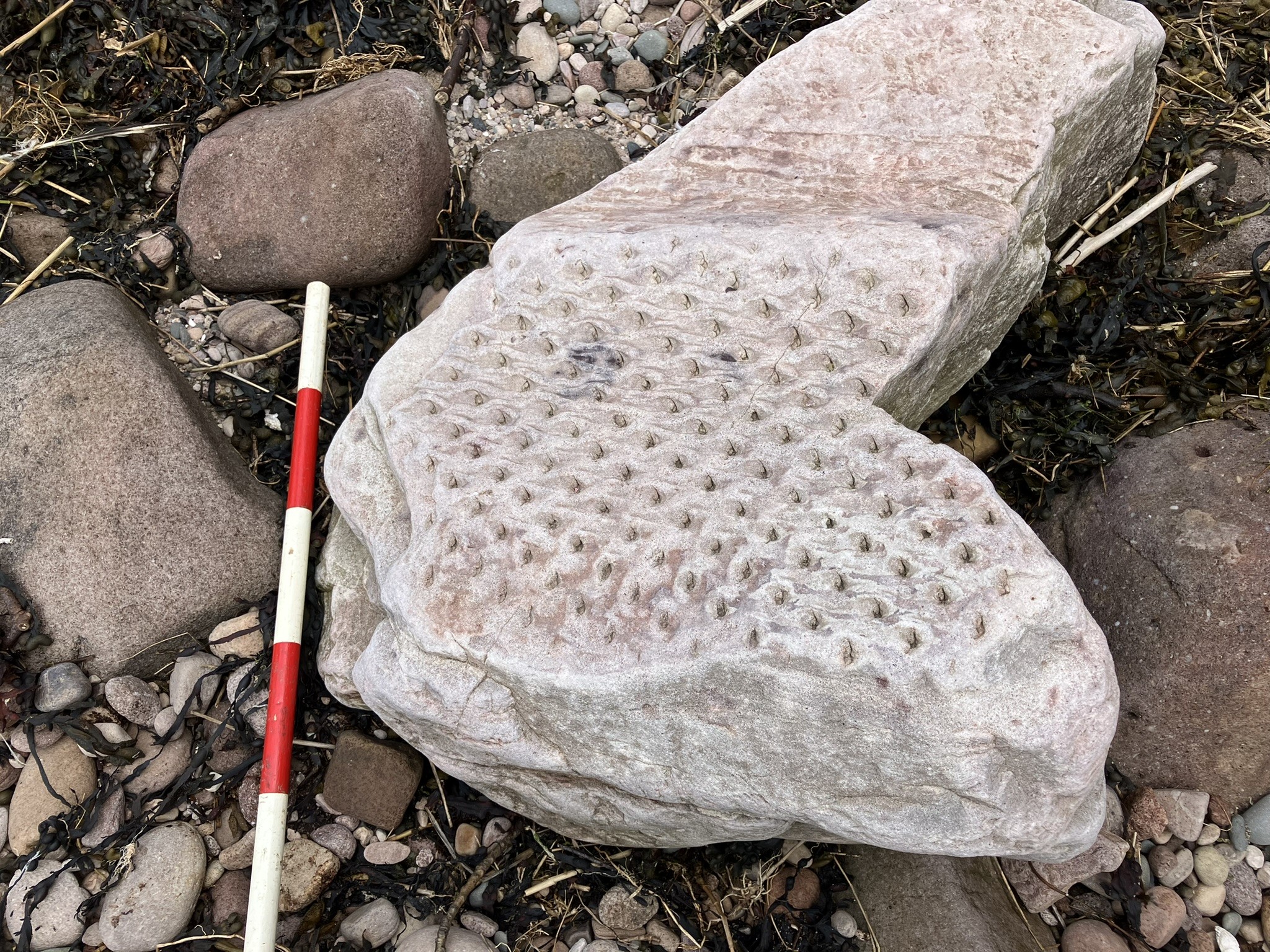
Another low cliff brought us some more fossils, but of a quite different kind. After a global sea-level rise, this area was under a shallow sea and this rock surface was originally the seabed. It was covered in ‘trace’ fossils – tracks and burrows left by the creatures that lived here (photograph 4).
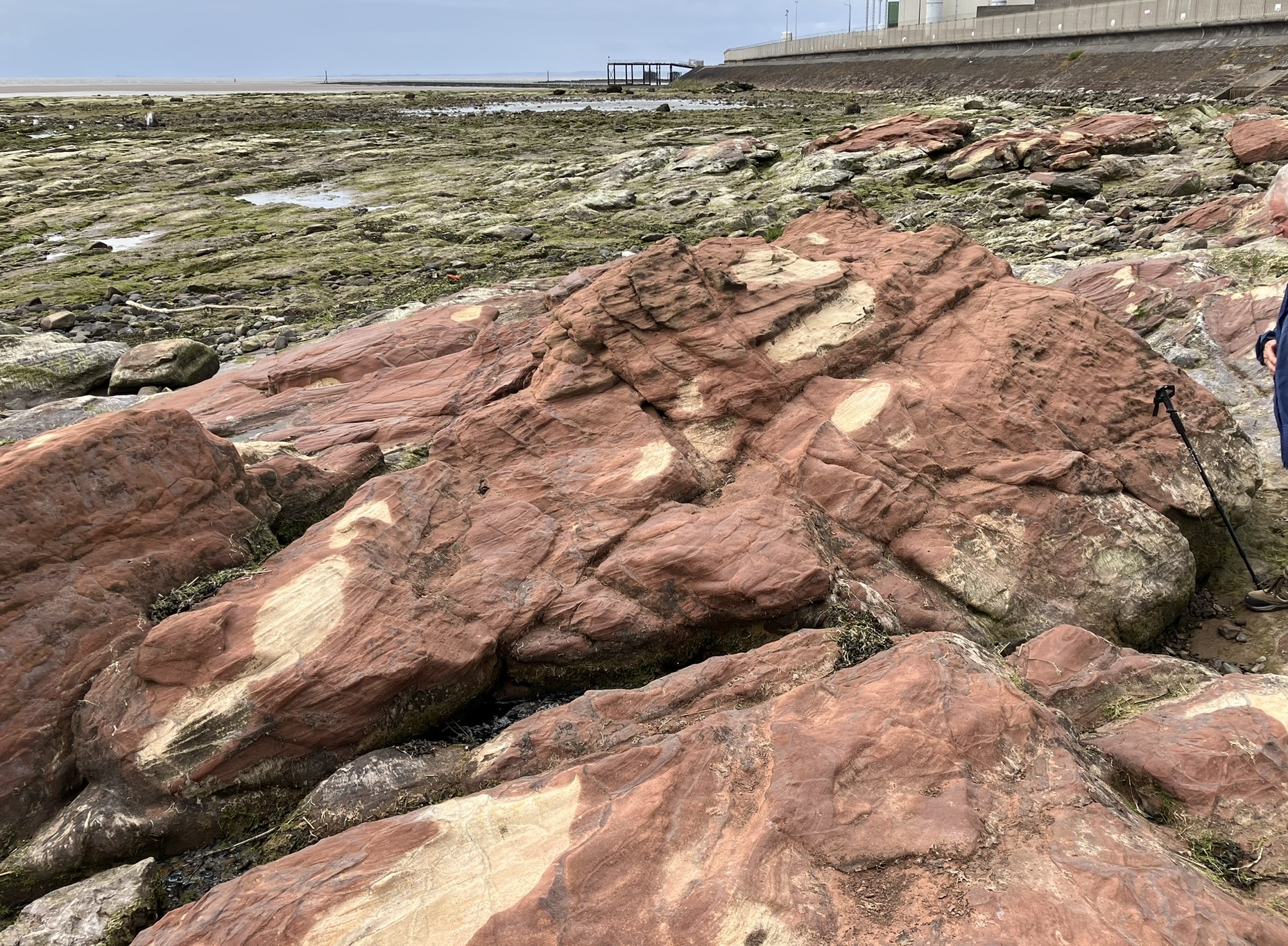
We finished with a walk past the nuclear power station onto the foreshore, where the rocks are Triassic, about 250 million years old. They were created by a huge river system running through a desert, not unlike the Nile today. The pink sandstone shows ‘cross-bedding’, distinctive patterns formed as large ripples in the river bed were deposited and then cut through as the current moved and new channels were created. However, the rock’s colour is mottled with pale patches. These reflect changes to the chemistry of the iron minerals, caused by pockets of gas rising from deeper rocks (photograph 5). The Morecambe Bay gasfield is of course just a few miles out to sea from here.
u3a Geology Field Trip To The Manifold Valley, October 2022
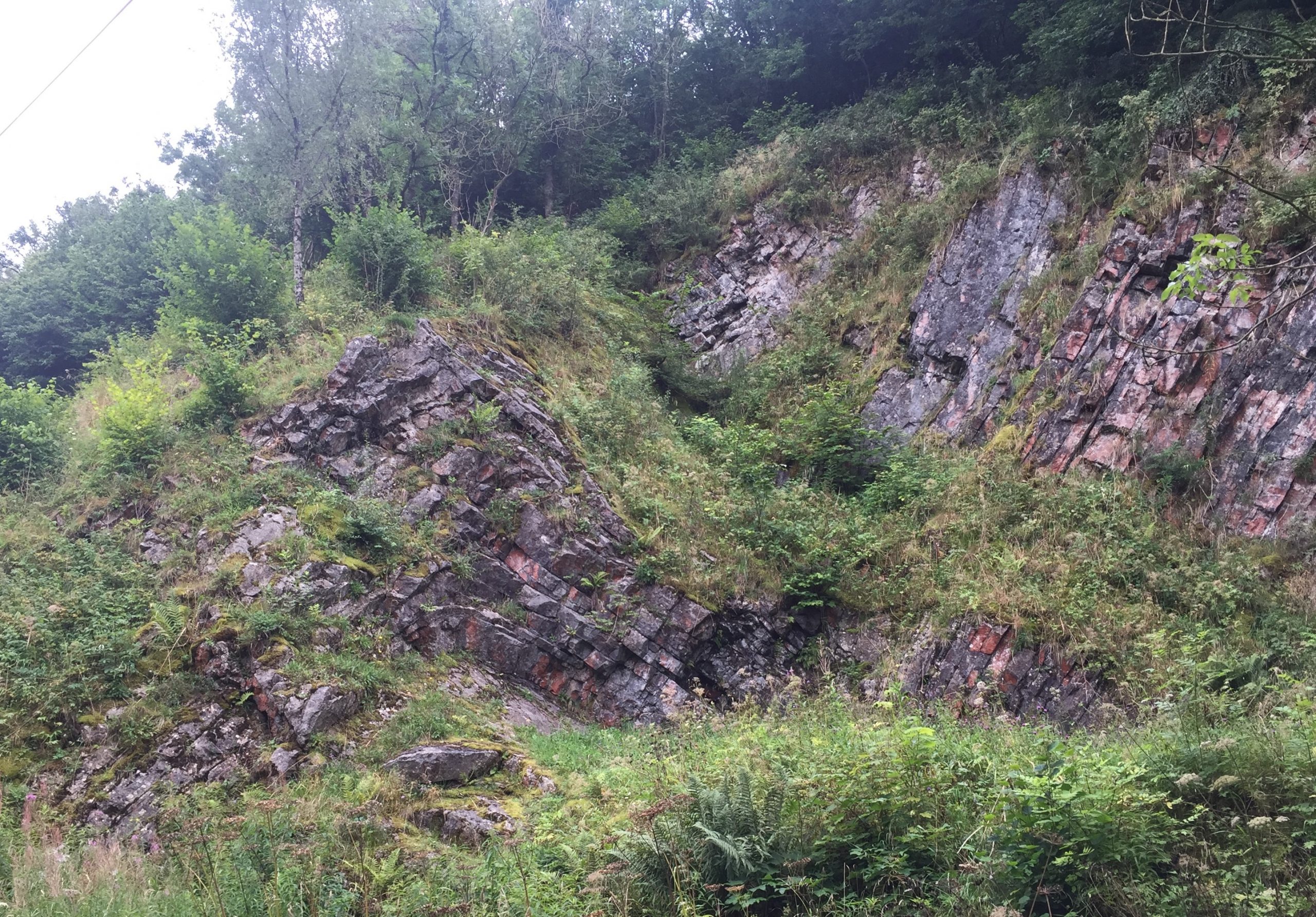
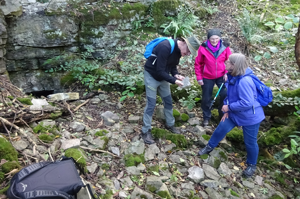
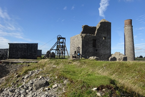
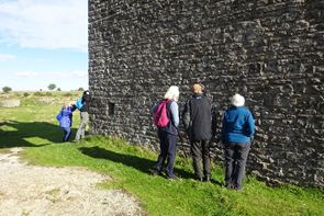
The geology group made an autumn visit to the Manifold Valley in Staffordshire, at the southern end of the Peak District, beginning with a morning near Ecton Mine. At the end of the 18th century, Ecton Mine was the richest copper mine in the world and made its owner, the Duke Of Devonshire, wealthy. The rocks around the mine are about 330 million years old and comprise beds of limestone interlain with thin shale bands, with impressive folds (photograph 1). They were originally deposited on an undersea slope, where periodic sediment slides brought limey mud down from shallower areas – these now form the limestone layers. In between these events, the deposition was a slow accumulation of fine mud particles, and these have now become the shale bands. We saw evidence of the formation process in the form of fossils of marine creatures, rather broken up by their journey and deposition. Around 300 million years ago, tectonic plate movements compressed this area and caused the folding we admired.
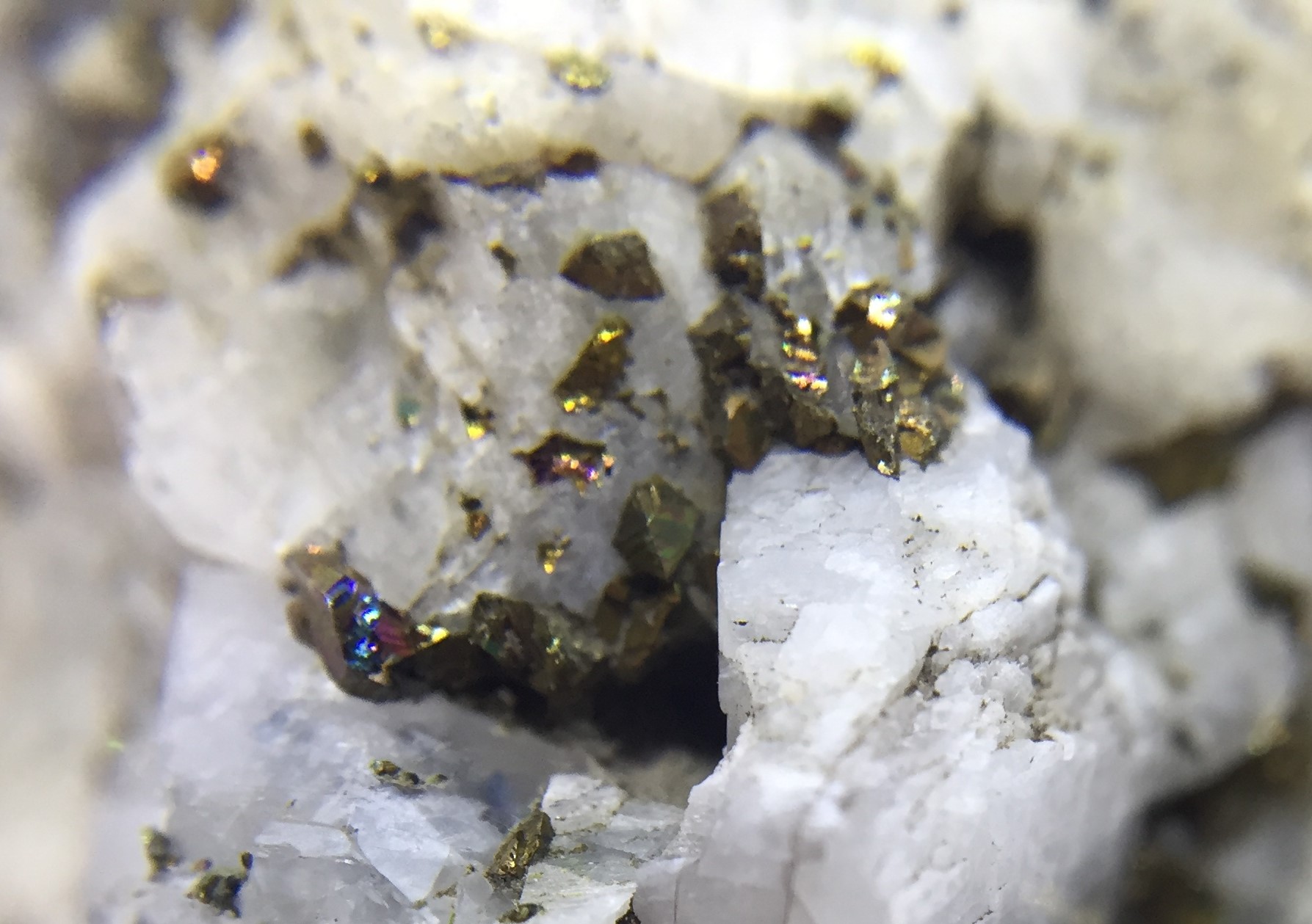
There were reminders of the mining history, particularly spoil heaps where we found remnants of the copper ores. The main ore was chalcopyrite – we found a few small crystals embedded in the limestone (photograph 2). We also saw some of the characteristic green and blue copper minerals that result from the chalcopyrite weathering – these included malachite and azurite (photograph 3).
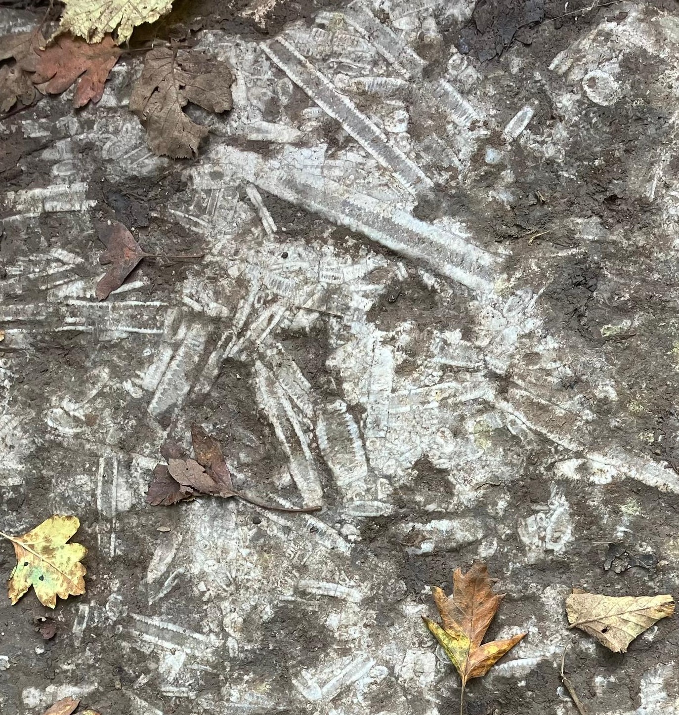
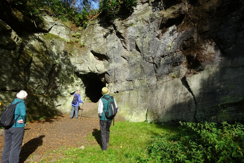
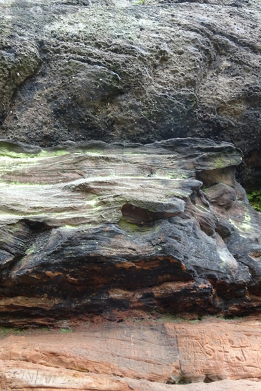
After a fine lunch at the Manifold Inn, we travelled a few miles south and then walked a short distance along the Manifold Way, to see Thor’s Cave. This was well worth the climb up about 200 stone steps, being a large natural opening in the limestone (photograph 4). Although the cave is now about 200 feet above the river, it was actually formed below river level over 300,000 years ago, by surface water percolating through cracks in the limestone and dissolving the rock away, thereby enlarging the voids. The limestone itself was also interesting – several million years younger than the rocks we had seen in the morning, and with none of the shale bands or bedding. At the time Britain was close to the Equator, and this rock was formed as part of a reef in a shallow tropical sea. In places the limestone contains abundant fossils of crinoids – commonly known as “sea lilies”, although they were actually marine animals (photograph 5).

u3a Geology field trip to Ashford-in-the-Water, October 2021
Six members of our geology group met up in Ashford-in-the-water on Wednesday 6th October- a glorious sunny day- and immediately went for coffee. After admiring the fine buildings of Ashford and the historic bridge over the River Wye we walked the short distance to the now abandoned quarry/mine that used to produce the famous Ashford black marble. This rock is not a marble at all but a very dark limestone which polishes to a deep black colour and was originally deposited in shallow tropical seas about 330 million years ago. We found the two entrances to the mine (now securely barred) and many samples of the black marble (photograph 1).
We then walked back to our cars and drove to the Cock and Pullet in Sheldon for lunch. After lunch we walked over to the nearby Magpie mine ruins (photograph 2). This was originally the site of several lead mines that were worked up to 1958 and the Magpie mine was the last working lead mine in Derbyshire. We found many fossils in the limestone blocks used in a stile on the walk to the mine as well as in the walls of the buildings (photograph 3).
As well as crinoids (photograph 4), which are a primitive relative of the modern sea lily we also found masses of brachiopods including the impressively large gigantoproductids. We also found some small samples of lead ore on one of the spoil heaps near the buildings.

Mark Barley November 2021
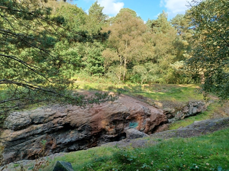
u3a Geology field trip to Alderley Edge, September 2021
On Friday September 17th 8 of us met up in the National Trust car park on Alderley Edge for a geologically themed walk around the local area led by Mike Regan. We started in Church quarry (photograph 1) where we found smooth sandstone, which had been quarried for building stone (used in local churches, hence the name of the quarry), was covered by a substantial layer of hard conglomerate. This conglomerate (known as the Wood Mine conglomerate) contained many rounded pebbles up to a couple of inches across. This deposit had been laid down during flash floods in a desert environment between 250 and 240 million years ago. Whereas a foot of the underlying sandstone may have taken millions of years to accumulate a foot of the conglomerate could have been deposited in a single flash flood.
Similar conglomerate rocks were seen at several other locations in our walk around Alderley Edge. The photograph below (2) shows a closeup of a conglomerate at Castle Rock, above sandstone that had been deposited as sand dunes in a Sahara-like desert. The fact that the conglomerate overhangs the sandstone (protecting it from the weather) suggests it is harder and more resistant than the sandstone. In fact this is an unconformity:- the sandstone layer was originally about 50 meters taller, but was eroded back to its present level before the conglomerate was deposited on top
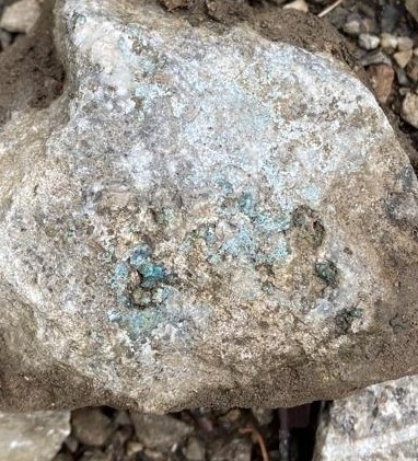
At Stormy point we searched for small flecks of Malachite and Azurite (several were found), copper ores that had been extracted from the nearby mines. We also had a look at the entrance to Engine Vein mine (photograph 3) from outside the fenced off compound. Mineralization is often due to hot fluids containing minerals circulating through faults and other weaknesses in the rocks. This is clearly seen in the photograph of Engine Vein mine where the miners have followed a fault, hacking out the minerals as they went. Note the green patch (of malachite) on the side of the rock cleft. We completed our visit by having lunch in the nearby Tea Room.
Mark Barley November 2021